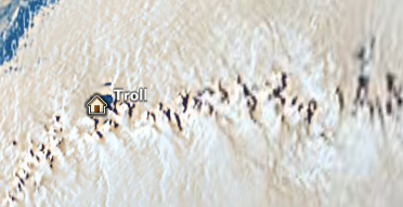
PolarView have released a .kmz file for Google Earth providing more Antarctic data, including the location of drift buoys, larger identified icebergs, selected research vessels and research stations, as well as some higher resolution imagery. Naturally I was drawn to Troll, the Norwegian base on Queen Maud Land (named by a popular vote of Norwegian schoolchildren).
Who knows whether I’ll ever make it to Antarctica for real, but in the meantime my name at least will be heading SOUTH with the Ben Saunders’ sledge. I’ve just purchased mile 897 of Ben and team-mate Tony Haile’s 1800-mile trip to the pole and back.